References
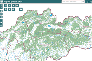
Customers of different specializations use our professional services for map visualizations, spatial analyses and geographic information systems.
Customers of different specializations use our professional services for map visualizations, spatial analyses and geographic information systems.

The aim of the project is to identify critical places in the cultural landscape, where human activities prevail over natural ones, which are most vulnerable to flash floods. In doing so, we recognise the ecological and economic risk and, of course, the potential threat to human life and health.

The basic objective of the project is to identify the so-called Natural and Landscape Capital as an aggregate of natural and socio-economic resources and potentials, while it is necessary to further define these according to their suitability for human use and the limits to such use.

In cooperation with Kaufland, the analysis of transport accessibility, the suitability of the site in relation to the population, competition and the suitability of the site in relation to the economic potential was addressed. At the same time, procedures such as a spatial interaction model with catchment area delineation and an econometric model using Google Trends with resulting sales estimates were applied.

The aim of the project was to create a set of technical means, tools, data and measures that will contribute to a more efficient decision-making process and crisis management communication, and enable monitoring, evaluation and management of emergencies and crisis situations .
The aim of the project was to produce basic information for landscape-ecological planning, including the production of USES documents based on the services and data of the European COPERNICUS programme for monitoring of the environment and security.
The subject of the project was the development of a universal procedure and supporting tools for the purpose of elaboration of MUSES.
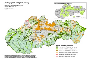
The aim of the project was to elaborate individual nature and landscape protection documentation (RÚSES) in accordance with Act No. 543/2002 Coll. on nature and landscape protection as amended for 42 selected districts.

The task evaluated the manifestations of pollution in the DPZ images. Both temporal and spectral changes at individual sites were evaluated. In addition to the DPZ images, the geostatistical parameters affecting the spread of pollution to groundwater were refined and used to calculate a pollution spread model. In addition to the above, 3D models of the hydrogeological environment were constructed at selected sites.

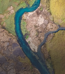
On the basis of mathematical modelling of the impact of scenarios of measures in the basins (560 profiles) on the peak flow and design flood wave caused by causal precipitation with a probability of recurrence of 100 years, the effectiveness of natural measures in forests, agricultural land and urbanised areas was evaluated and the need for implementation of technical measures proposed in the flood risk management plans of individual sub-basins of the Slovak Republic was demonstrated in order to meet the objectives of Article 2.1.1 of Regulation (EC) No. 1 of the Flood Risk Assessment and Management Directive - to reduce the adverse effects of floods on human health, the environment, cultural heritage and economic activity.

Development of a Web GIS application containing several GIS and modelling tools for the operational solution of water management tasks, which serves as the main tool for testing mapping, analytical and reporting services integrated into the "TIS" portal of the Slovak Water Management Company.

The aim of the task was the analysis, interpretation and synthesis of remote sensing data (multispectral satellite images and detailed aerial images from different time stages, hyperspectral aerial images) over probable environmental burdens at 87 defined locations in Slovakia, collection and evaluation of a set of documents and information and subsequent modelling of surface and subsurface spreading of pollution.
The project was a continuation of the Comprehensive Geological Information Base for Nature Conservation and Landscape Management task, which focused on the creation and characterization of abiocomplex synthesis types that are the building blocks of regional geoecological studies as well as applied environmental studies. Within the framework of the project, the created abiocomplexes were further updated and supplemented with additional attributes characterizing the abiotic component of the environment as well as the occurrence and threat of natural stress factors and geoecological hazards.
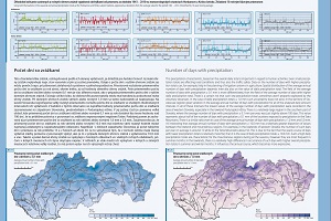
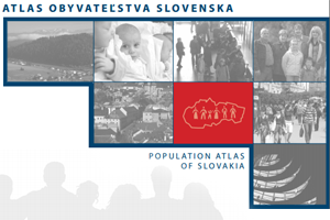
The main objective of the project was to create a comprehensive cartographic work Climate Atlas of the Slovak Republic in printed form and in the form of a WEB GIS application.
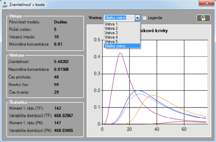
The aim of the project was to assess the risks of groundwater quality in the BSK with the development of proposals for protective measures for their sustainable use. Within the framework of the project, the research team of ESPRIT spol. s r.o. carried out the following sub-tasks under the direction of the responsible investigator in the form of an external study: analysis and modification of the algorithm of the one-dimensional advection-dispersion transport model with dual porosity published in (F. Cornaton & P. Perrochet, 2001) and its implementation in the modelling software. Creating and populating a geospatial database with relevant spatial data necessary for the operation of the modelling software components. Creation of outputs and their integration in the internet environment - calibration of the model and creation of a groundwater vulnerability map. Geographical spatial analysis of risks resulting from the degree of groundwater vulnerability and existing contamination load in the territory of BSK. Uploading the outputs to the geographical database and the web portal.

The aim of the project was to modernize and supplement the technical infrastructure of the Institute of Landscape Ecology of the Slovak Academy of Sciences - branch in Nitra for research in the field of landscape ecology, landscape ecological planning, landscape management and long-term ecological research of ecosystems. The project has two main themes: 1) building and modernisation of local supporting infrastructure for research and development in the field of information technologies based on GIS technologies to support research activities in the field of landscape ecology, through server and mobile application GIS equipment and a comprehensive information system for the purposes of ecological planning and landscape management; 2) building and modernisation of infrastructure for ecosystem research. 1) Creation of a system, consisting of technical infrastructure, standard and specialised software and spatial database, enabling a new quality of landscape ecological research for the needs of landscape ecological planning and landscape management; 2) Supplementation of the instrumentation of the department to support and expand the possibilities of ecosystem research with a focus on mountain meadow and forest ecosystems, including the impact of global change.
Within the framework of the project, the nature and landscape protection documentation (RÚSES) was comprehensively processed in accordance with Act No. 543/2002 Coll. on nature and landscape protection as amended for individual districts - Spišská Nová Ves, Žiar nad Hronom, Turčianske Teplice, Svidník, Ružomberok, Poprad, Tvrdošín.
The aim of the project was the development of an expert operational system for the determination of hydrological and climatic design variables for flood protection of towns and villages in the Slovak Republic.
Within the framework of the project, in cooperation with partners NLC-Zvolen and ŠGÚDŠ Bratislava, a comprehensive complex simulation and modelling tool was developed, which includes tools and an extensive database of input geographic data for rainfall-runoff modelling, erosion modelling and pollution propagation, adapted to Slovak physical-geographical conditions and providing extensive possibilities for assessing and predicting changes in the behaviour of the entire catchment system depending on natural and anthropogenic influences. The modelling tool has been used in several projects and tasks (e.g. Hydrofor (HUSKROUA/1101/262), National Forestry Centre, SVP - Assessment of the potential impact of existing and proposed preventive measures in the catchment on the achievement of the objectives of the flood risk management plan - modelling of rainfall-runoff processes and hydrological response of the catchment to defined scenarios).

The subject of the delivery was a fully functional stand-alone software - geographic information system, capable of visualizing, managing, creating and analyzing geographic data with the possibility of working with geographic network type data to provide IT support for waste management. Based on the use of the information of the collection information system, i.e. the precise quantification and spatial localisation of waste in all procedural stages of collection, it is possible, in cooperation with GIS technologies, to carry out a detailed and qualitatively more valuable spatial analysis of the generation and treatment of waste and to optimally manage the entire system by evaluating the current state of the location of points of interest and optimising it, by implementing a dispatcher workstation and by integrating it with other components of the municipal IS.
The subject of the project were the following activities: - Design and implementation of GIS server environment
- Design of the structure and implementation of the geodatabase
- Cartographization and publication of mapping services for air quality management and for the Climatological and Meteorological Information System
- Development of geoprocessing tools and their publication through standardised services for use in web applications.
- Design and implementation of standard WEB-GIS functionalities
- Design and implementation of specialised GIS functionalities for air quality management via web applications
- Design and implementation of specialised WEB-GIS functionalities for the Climatological and Meteorological Information System
The subject of the project were the following activities:
- Design and implementation of a GIS server environment
- Design of the structure and implementation of the geodatabase
- Cartographization and publication of map services for the needs of the Water Information System
- Development of geoprocessing tools and their publication through standardised services for use in web applications.
- Design and implementation of standard WEB-GIS functionalities
- Design and implementation of specialised GIS functionalities for the needs of the Water Information System via web applications
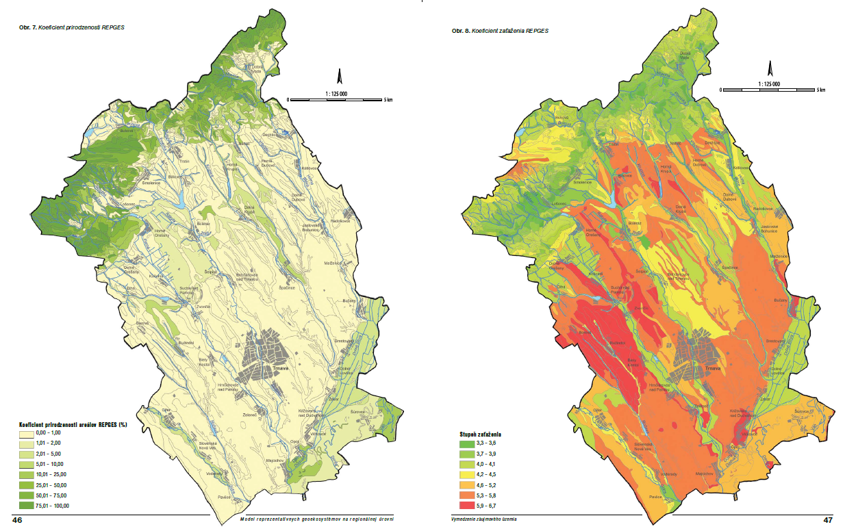
The aim of the project was to develop a methodological approach for the creation and assessment of representative geoecosystems at the regional level in order to develop an effective biodiversity conservation strategy. The sub-objectives can be considered as:
• Development of a methodological procedure for the delineation of REPGES at regional level
• Establishment of criteria for the assessment of REPGES (current state of their use, conservation and threats) and their application at the level of individual regions of the Slovak Republic
• Establishing a biodiversity conservation strategy based on the protection of REPGES

In cooperation with KVHK SvF STU Bratislava, a tool (distributed hydrological model) was developed to model hydrological processes in catchments without observation of hydrological elements. The conceptual structure of several existing hydrological models was used as a basis for the development of the model. Existing solutions were modified to be suitable for modelling runoff from precipitation and snowmelt in our physical-geographical conditions. Combining physical and empirical relationships, we modeled the following hydrologic processes: precipitation, snow accumulation and snowmelt, interception, accumulation in surface depressions, surface runoff, infiltration, evapotranspiration, percolation, hypodermal runoff, baseflow, and water balance in the root and saturated zones.

The aim of the geological task project was to create multifunctional usable geological and hydrogeological bases of the primary landscape structure for optimal nature protection and rational landscape management (landscape-ecological planning) for the whole territory of Slovakia and to create unified regional characteristics of morphological and geological zonation of the territory, processing of data on groundwater levels and resources, their natural and legislative protection.
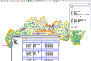
Analysis, design, development, implementation, support, maintenance and development of the WebGIS system to ensure the provision of geological data (spatial and non-spatial) to the widest possible range of professional and lay users through an open information system built on the basis of web technologies. The output is an integrated expert system covering the information needs not only of all geological professions but also for educational and lay educational-promotional needs. The complexity of the applications corresponds to such a user structure. From explicitly expert-oriented geological, geophysical, hydrogeological map applications to popular educational applications such as map applications of important geological sites or geoparks.

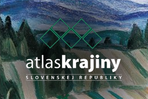
An important cartographic work which was awarded the Cartographic Work of the Year in the Atlases category at the conference of the International Cartographic Association in Paris.
Analysis, design, development, implementation, support, maintenance and development of the WebGIS system to ensure the provision of geological data (spatial and non-spatial) to the widest possible range of professional and lay users through an open information system built on the basis of web technologies. This has been achieved by: - Establishing the structures of the different geological data streams developed on the basis of an analysis of the current status and needs of all stakeholders.
- Developing the design of the system architecture.
- Creation and maintenance of a database with a special focus on the spatial aspect.
- Development and implementation of a number of server-based mapping, geoprocessing and standard services.
- Development and implementation of a number of client mainly map applications.
The output is an integrated expert system covering the information needs not only of all geological professions but also for educational and lay educational-promotional needs. The complexity of the applications corresponds to such a user structure. From explicitly expert-oriented geological, geophysical, hydrogeological map applications to popular educational applications such as map applications of important geological sites or geoparks.
more >
The output of the project was the Catalogue of landscape-ecological objects as a basic methodological and integration tool for building spatial databases. For the purposes of cataloguing, the data bases and data needs of all components of the Department of Environment were analysed. These were then multi-criteria assessed and subsequently catalogued according to currently valid methodological and legislative documents.
The project focused on the creation of a spatial database and application solution for the needs of the European Water Directive. The database was created by integrating and modifying existing SHMÚ resources and creating new data objects with a focus on ensuring spatial and logical integrity. Primary attention was paid to all data with a direct or indirect link to water bodies, broken down by landscape structures.
Development of a communication system and integration of data from automatic hydrological, rainfall and meteorological stations, satellite, radar and other relevant information on the basis of a database server. Development of systems for user and administrator management of data areas. GIS applications for the POVAPSYS central display interface with tools for displaying normal and crisis conditions for the main hydrological characteristics.
Within the geological task, a detailed characterization of the abiotic part of the primary landscape structure was processed, with direct use of the outputs for a comprehensive landscape-ecological information base on a unified cartographic basis for the entire territory of the Slovak Republic.
Within the framework of the project, erosion and accelerated surface runoff hazards were modelled for the whole of Slovakia on the basis of detailed databases characterising individual geosystem elements, with output into cartographically expressed proposals for measures to improve the retention capacity of the territory and proposals for anti-erosion measures in individual sub-basins. The outputs are part of the documents Water Plan of the Slovak Republic, Preliminary Flood Risk Assessment.
The main task was the processing and compilation, prepress preparation and printing of a representative work of Slovak science, which contains about 760 maps in scales from 1:10 000 to 1:4 000 000. The work was processed in the form of a printed book, an electronic book and a DVD.
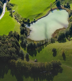
The task was focused on a comprehensive landscape-ecological and water management assessment of the processes associated with silting of the reservoir.
- Geochemical Atlas of Slovakia: natural radioactivity of rocks
- Geochemical Atlas of Slovakia: forest biomass
- Geochemical Atlas of Slovakia: Groundwater
- Geothermal Atlas of Slovakia 1994 - 1999 Map of water protection - set of maps of Slovakia at a scale of 1:50000