References
Customers of different specializations use our professional services for map visualizations, spatial analyses and geographic information systems.
Customers of different specializations use our professional services for map visualizations, spatial analyses and geographic information systems.

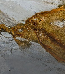
The task evaluated the manifestations of pollution in the DPZ images. Both temporal and spectral changes at individual sites were evaluated. In addition to the DPZ images, the geostatistical parameters affecting the spread of pollution to groundwater were refined and used to calculate a pollution spread model. In addition to the above, 3D models of the hydrogeological environment were constructed at selected sites.

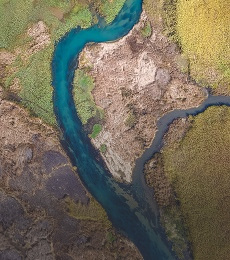
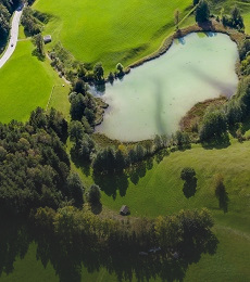
The aim of the task was the analysis, interpretation and synthesis of remote sensing data (multispectral satellite images and detailed aerial images from different time stages, hyperspectral aerial images) over probable environmental burdens at 87 defined locations in Slovakia, collection and evaluation of a set of documents and information and subsequent modelling of surface and subsurface spreading of pollution.
The project was a continuation of the Comprehensive Geological Information Base for Nature Conservation and Landscape Management task, which focused on the creation and characterization of abiocomplex synthesis types that are the building blocks of regional geoecological studies as well as applied environmental studies. Within the framework of the project, the created abiocomplexes were further updated and supplemented with additional attributes characterizing the abiotic component of the environment as well as the occurrence and threat of natural stress factors and geoecological hazards.

The aim of the geological task project was to create multifunctional usable geological and hydrogeological bases of the primary landscape structure for optimal nature protection and rational landscape management (landscape-ecological planning) for the whole territory of Slovakia and to create unified regional characteristics of morphological and geological zonation of the territory, processing of data on groundwater levels and resources, their natural and legislative protection.
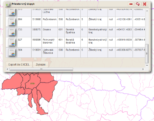
Analysis, design, development, implementation, support, maintenance and development of the WebGIS system to ensure the provision of geological data (spatial and non-spatial) to the widest possible range of professional and lay users through an open information system built on the basis of web technologies. This has been achieved by: - Establishing the structures of the different geological data streams developed on the basis of an analysis of the current status and needs of all stakeholders.
- Developing the design of the system architecture.
- Creation and maintenance of a database with a special focus on the spatial aspect.
- Development and implementation of a number of server-based mapping, geoprocessing and standard services.
- Development and implementation of a number of client mainly map applications.
The output is an integrated expert system covering the information needs not only of all geological professions but also for educational and lay educational-promotional needs. The complexity of the applications corresponds to such a user structure. From explicitly expert-oriented geological, geophysical, hydrogeological map applications to popular educational applications such as map applications of important geological sites or geoparks.
more >
Analysis, design, development, implementation, support, maintenance and development of the WebGIS system to ensure the provision of geological data (spatial and non-spatial) to the widest possible range of professional and lay users through an open information system built on the basis of web technologies. The output is an integrated expert system covering the information needs not only of all geological professions but also for educational and lay educational-promotional needs. The complexity of the applications corresponds to such a user structure. From explicitly expert-oriented geological, geophysical, hydrogeological map applications to popular educational applications such as map applications of important geological sites or geoparks.
Within the geological task, a detailed characterization of the abiotic part of the primary landscape structure was processed, with direct use of the outputs for a comprehensive landscape-ecological information base on a unified cartographic basis for the entire territory of the Slovak Republic.
- Geochemical Atlas of Slovakia: natural radioactivity of rocks
- Geochemical Atlas of Slovakia: forest biomass
- Geochemical Atlas of Slovakia: Groundwater
- Geothermal Atlas of Slovakia 1994 - 1999 Map of water protection - set of maps of Slovakia at a scale of 1:50000